Station Map/nl: Difference between revisions
Updating to match new version of source page |
Created page with "Het sporenplan is een {{pll|Items Overview|voorwerp}} in de vorm van een boek. In tegenstelling tot de {{pll|World Map|wereldkaart}}, die enkel het algemene spoorwegnet en locaties van stations laat zien, toont een sporenplan de {{pll|Railway Terminology|sporen en emplacement-indelingen}} binnen stations in een schematische vorm." |
||
| Line 1: | Line 1: | ||
<languages /> | <languages /> | ||
Het sporenplan is een {{pll|Items Overview|voorwerp}} in de vorm van een boek. In tegenstelling tot de {{pll|World Map|wereldkaart}}, die enkel het algemene spoorwegnet en locaties van stations laat zien, toont een sporenplan de {{pll|Railway Terminology|sporen en emplacement-indelingen}} binnen stations in een schematische vorm. | |||
<div lang="en" dir="ltr" class="mw-content-ltr"> | <div lang="en" dir="ltr" class="mw-content-ltr"> | ||
Revision as of 12:32, 23 April 2025
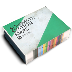
Het sporenplan is een voorwerp in de vorm van een boek. In tegenstelling tot de wereldkaart, die enkel het algemene spoorwegnet en locaties van stations laat zien, toont een sporenplan de sporen en emplacement-indelingen binnen stations in een schematische vorm.
It is used for navigation and identification of tracks, switches, service points, station offices, shops and other features within a station. To help identify these features, there’s a legend view on the first page.
Similar to the route map, the station map allows reading and changing switches remotely, if you own the Dispatcher license, by aiming at the switch icons and interacting with them.
Each yard layout shows world directions and orientation to the nearest station office, which can help navigate in combination with a compass.
De onderkant van de tekening is voorzien van tabbladen voor snelle navigatie op stationsnaam.
Dit voorwerp wordt helemaal aan het begin van de sessie verkregen en kan bij verlies geforceerd teruggevonden worden met behulp van het menu.